


 71 / 92

71
UAV, to use the Lancaster platform for
extended and beyond-line-of-sight
operations for applications including
monitoring mobile and static property
and changes in the environment.
PrecisionHawk also works with DJI
on rotary systems, and they have
jointly developed an easy-to-use data
acquisition and management package
for use by farmers. PrecisionHawk has
developed control software for two DJI
drone models – the Matrice M100 and
M600 – to operate the machines and
manage the imagery captured.
The Smarter Farming package
combines the DJI M100 or M600
Matrice UAVs, which have a flight
time of up to 40 minutes, with
PrecisionHawk’s DataMapper inflight
app for data collection and a one-year
subscription to DataMapper for data
management analysis.
The combination aims to bridge
the gap from flight to geospatial data
analysis so that more people can use
the technology more often, says Patrick
Lohman, vice-president of partnerships
at PrecisionHawk. “We wrote an app,
DataMapper, that tells the UAV what to
do. Flick a button and it takes off, tell it all
the waypoints – we handle the geometry
calculations – and it takes a path to take
the pictures and comes back and lands
where you tell it to,” he said. “We’ve taken
the human out of the loop for gathering
the information.”
With DataMapper, a user can create
a flight plan and autonomously collect
geospatial data. The images are
viewable in DataMapper, where they
are processed into 2D and 3D maps
and made ready for further analysis.
Users also have access to DataMapper’s
library of analysis algorithms that provide
detailed information for farmers with
different data depending on the season.
PrecisionHawk has a staff of remote
sensing data scientists who build the
algorithms on which the software works.
The system can measure plant counts
and plant height, and PrecisionHawk is
working with more partners in agriculture
such as Du Pont.
Mine clearance
UAVs are also being used to enhance the
detection and clearing of landmines. In
one study, researchers from the University
of Bristol have flown a UAV over
Manchester United’s Old Trafford football
pitch to show how large areas can be
mapped quickly. The two-year project has
been funded by the Find a Better Way
charity, which was set up by the club’s
legendary striker Sir Bobby Charlton, and
the UAVs will obtain high-resolution
UAVs
|
Insight
Unmanned Systems Technology
| June/July 2016
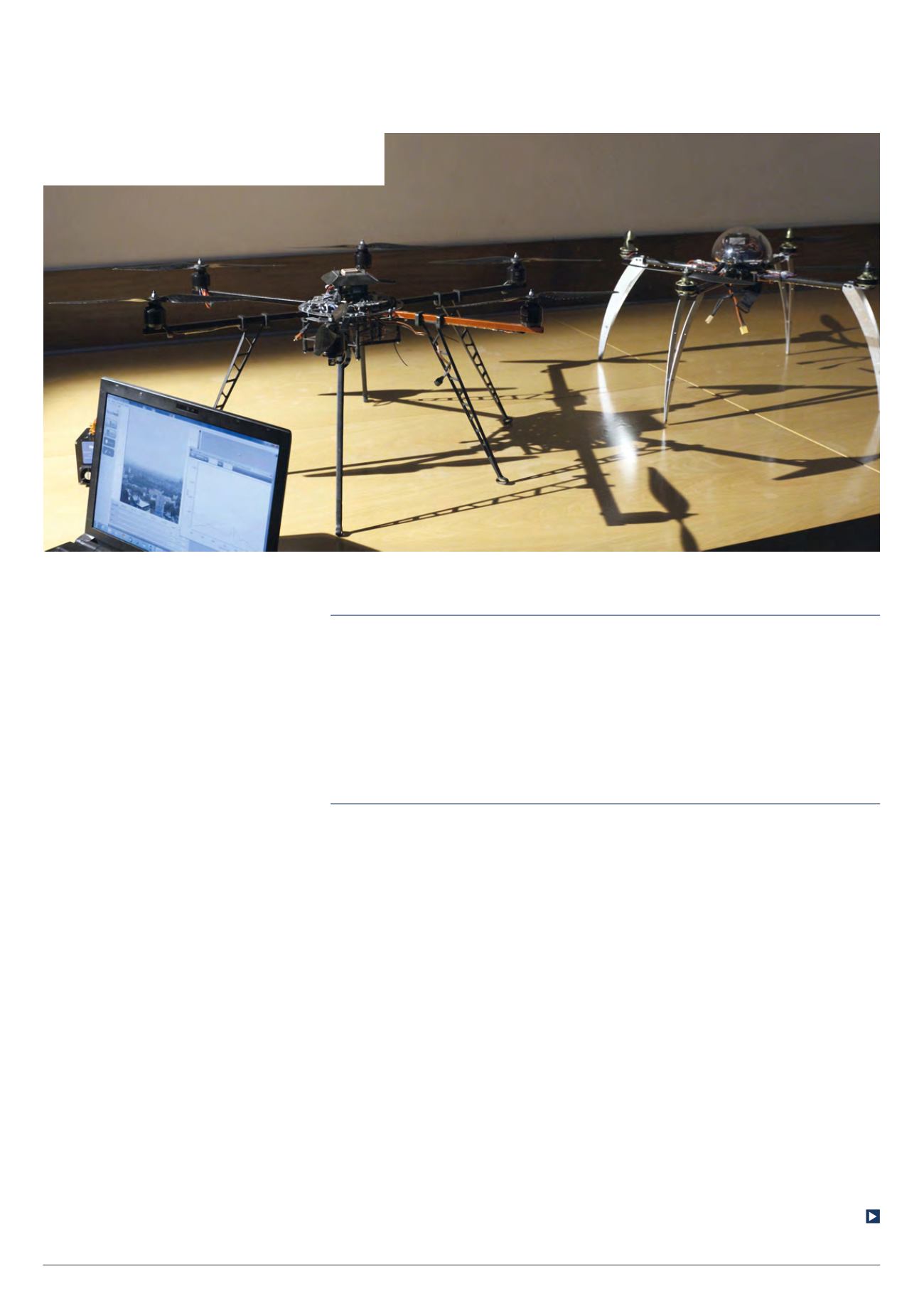
Researchers at the University of Bristol are using these
quadcopters with different camera payloads to locate
landmines quickly and safely (Courtesy of Find a Better Way)
The app tells the UAV what to do; it
takes a path and comes back where
you tell it to. We’ve taken the human
out of the information-gathering loop