


 70 / 92

70
U
nmanned aircraft face a
continuing engineering
challenge of the trade-off
between their lifting power
and range. Developers
of battery-powered rotary systems
are looking to increase the range and
endurance with hydrogen fuel cells, but
face a fundamental limit in the power-
to-weight ratio of existing batteries.
Providing more power needs larger,
heavier batteries, limiting the endurance
and lifting power.
Larger, diesel-engined craft provide
more endurance, from small, 5 m
systems up to full helicopter systems that
can carry large loads or several people.
UAV developers are now converting
existing helicopter platforms to make
them autonomous by fitting more
complex control systems and secure
communications links.
Fixed-wing designs aim to overcome
the endurance challenge, providing
longer time in the air and covering a
greater distance with higher minimum
speeds than rotary craft, putting a strain
on the sensors as they have less time to
capture data.
Developers are therefore looking at
new system-wide techniques to provide
the coverage that customers are asking
for. Using a fleet of battery-powered
rotary craft that can autonomously return
to a wireless charging point can provide
constant coverage for surveillance
applications, but require more complex
control algorithms.
Photography has been one of the
major drivers of UAV technology in the
past few years, but applications such as
those in agriculture are using the same
camera technologies to analyse the
state of vegetation. This idea is being
extended even further with the concept
of a swarm of UAVs in the air at the
same time with different types of sensors
such as electro-optic (EO) cameras for
visible light and infrared for detecting
changes in the vegetation.
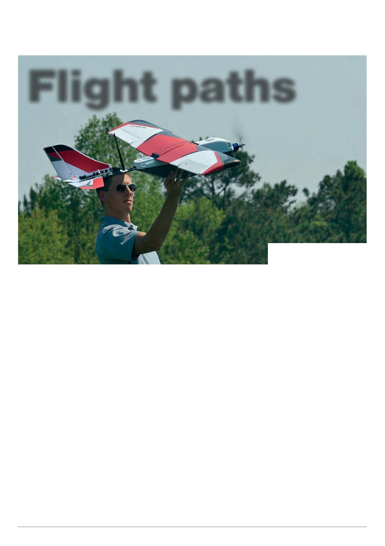
PrecisionHawk, for example, has
unveiled its latest single-engined fixed-
wing platform for carrying complex
cameras across fields. The Lancaster 5
has a wingspan of 1.5 m and weighs
2.4 kg with a 1.155 kg payload. With a
typical speed of up to 50 kph from the
7000 mAh battery, it can survey an area
of 300 acres at a height of 100 m with
a flight time of 45 minutes. The comms
system provides a link over 2 km for
data, and the whole system is controlled
by a dual-core processor running the
Linux operating system.
PrecisionHawk has also teamed up
with Insitu, which has its own ScanEagle
Flight paths
June/July 2016 |
Unmanned Systems Technology
Nick Flaherty
highlights some of the latest
developments in unmanned aircraft systems
The Lancaster 5 UAV can feed data back
from across fields for agricultural analysis
(Courtesy of PrecisionHawk)