


 44 / 92

44
Show report
|
AUVSI’s Xponential
He added that this development is
platform-agnostic relative to the type of
aircraft controlled. The display is user-
configurable, he also said. Moreover,
where there is a wi-fi link, it can be used
such that the device it is running on
becomes a standalone ground control
station, connecting directly to the craft
via wi-fi.
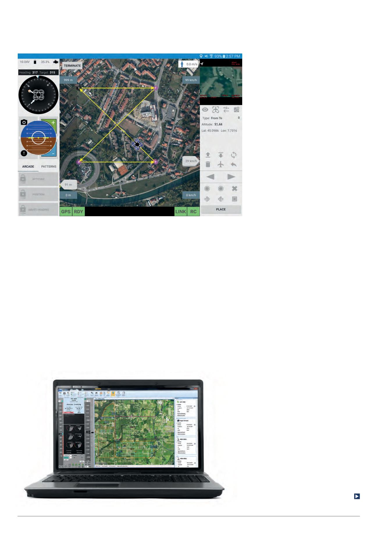
MicroPilot has already developed
Horizon ground control software for
desktop Windows, Mac, and Linux.
A weather window floating above the
scene shows wind and precipitation
data, while a red area draped on the
landscape shows where the fire is.
In the centre of the headset’s field
of view is a crosshair that serves as a
cursor and enables the wearer to point
at an object by looking at it and selecting
it with an ‘air tap’ gesture, which involves
holding a forefinger and thumb in an
L-shape in the middle of the field of view
and then bringing them together.
“While this is a simulation right
now, it’s sending real Stanag 4586
messages, which means that right now,
if we had a Stanag 4586-compliant
UAV, it could control it if we wanted it
to,” said Greer Carper of Insitu.
The system can also convert these
messages to the Micro Air Vehicle
Link (MAVLink) protocol. Many popular
quadcopters and fixed-wing aircraft
feature open source autopilots that use
MAVLink messages, so the system could
also control them, he added.
The UAV control window also has a
‘Slew payload’ button. Air tapping on
that, then on an area of interest, results
in white lines being projected from the
UAV symbol onto the ground to show
the sensor footprint. Another air tap on
the ‘View video’ button opens another
window with the imagery, which for the
demonstration was canned footage.
This video window could then be
clicked and dragged to anywhere in the
field of view, as could any other window.
The system also remembers the user’s
preferred settings.
David Dechant told us that Trimble
has just replaced its MB-One OEM
receiver module with the MB-Two (the
earlier model having in turn replaced the
MB-100). A straight swap for the MB-One
where a customer wishes to upgrade, the
MB-Two – like the MB-One – has L-band
capability, which can be purchased as
an option for the receiver. Dechant told
us that the MB-Two can use any GNSS
system for positioning without depending
on GPS.
June/July 2016 |
Unmanned Systems Technology
Insitu showed an augmented reality
version of its Inexa Control system
MicroPilot’s Horizon ground control suite
comes in desktop and mobile versions
Insitu demonstrated an augmented
reality system capable of managing
multiple vehicles in complex scenarios.
Put together in 12 weeks, the proof-of-
concept system combined a Microsoft
HoloLens headset with Insitu’s own Inexa
Control system, putting them to work in a
simulated wildfire-fighting scenario.
In the scenario, the headset shows
a colour 3D map of hilly terrain, which
was built using imported GIS data, in
this case from ESRI. With the headset
on, walking towards or away from the
map zooms it in and out, and walking
around it provides different perspectives.